The Giant's Causeway: The Truth Behind a Giant's Road to Scotland
More than 40,000 basalt columns step down into the sea on the coast of Northern Ireland. The legend of the giant who built a road to Scotland, and the 60-million-year-old lava lake that actually made it, in a short video and photos.
On the north coast of Northern Ireland, thousands of stone columns march in steps down into the sea. The place is called the Giant's Causeway. If a giant really did build this road, where was he going? Start with the short video.

 Watch the one-minute video on YouTube
Where the Antrim Plateau meets the sea
The Giant's Causeway lies on the Antrim coast, at the edge of the Antrim Plateau where the land drops to the sea. Britannica describes it as a promontory of basalt columns running for about 6 kilometres along the north coast. In 1986 it was inscribed as a UNESCO World Heritage Site, the Giant's Causeway and Causeway Coast. Most of the land is owned and managed by the National Trust, which has looked after it since 1961.

Forty thousand columns
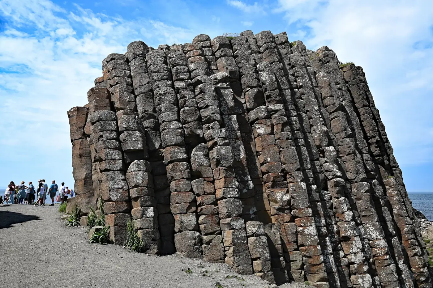
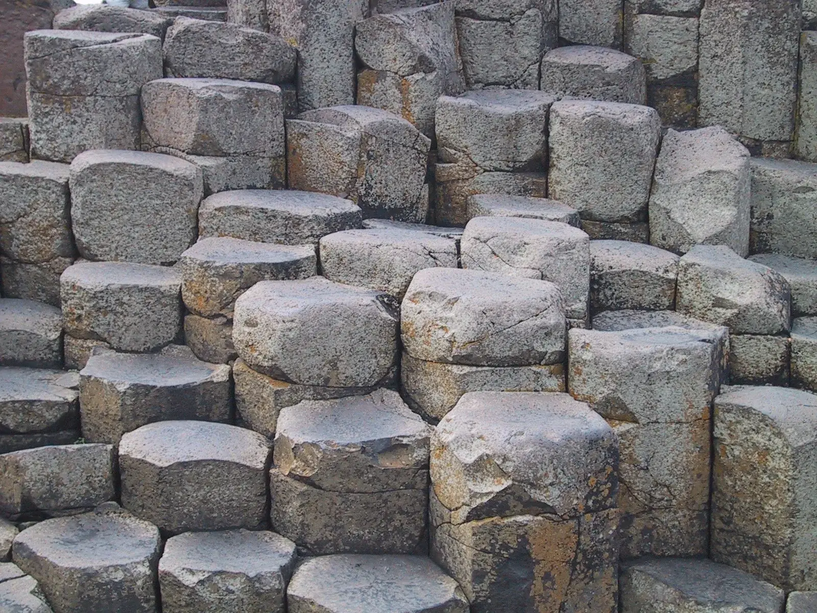
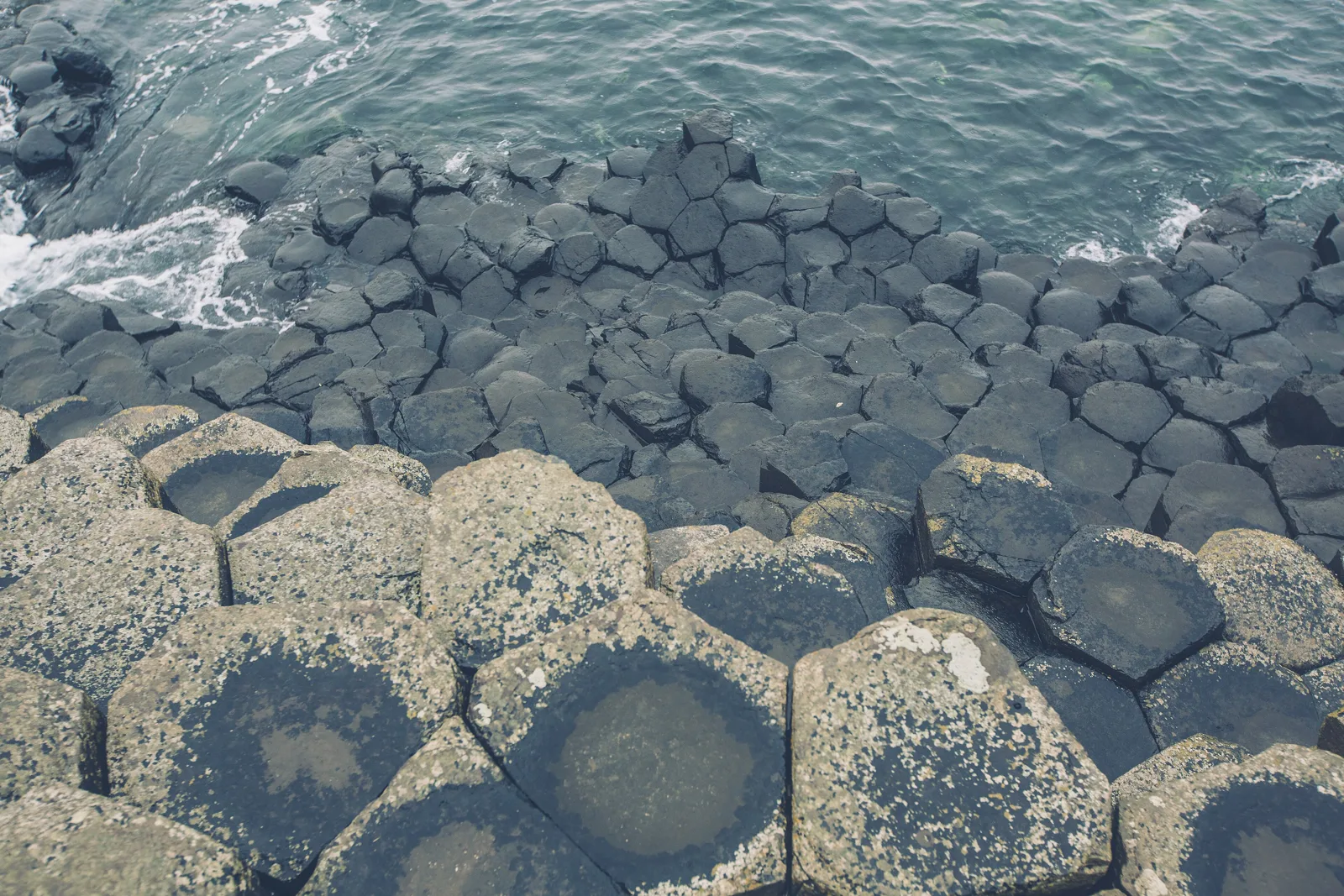
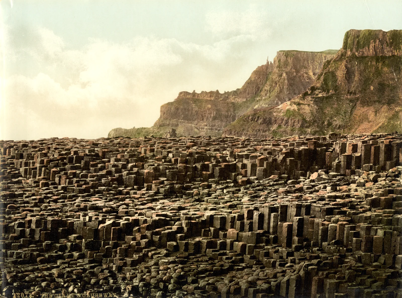
UNESCO counts some 40,000 large, regularly shaped basalt columns. Seen from above, most of them are hexagons, fitted together like a honeycomb. Because each column stops at a different height, the ground rises and falls like a staircase. It looks like masonry, but not a single stone was cut by hand.

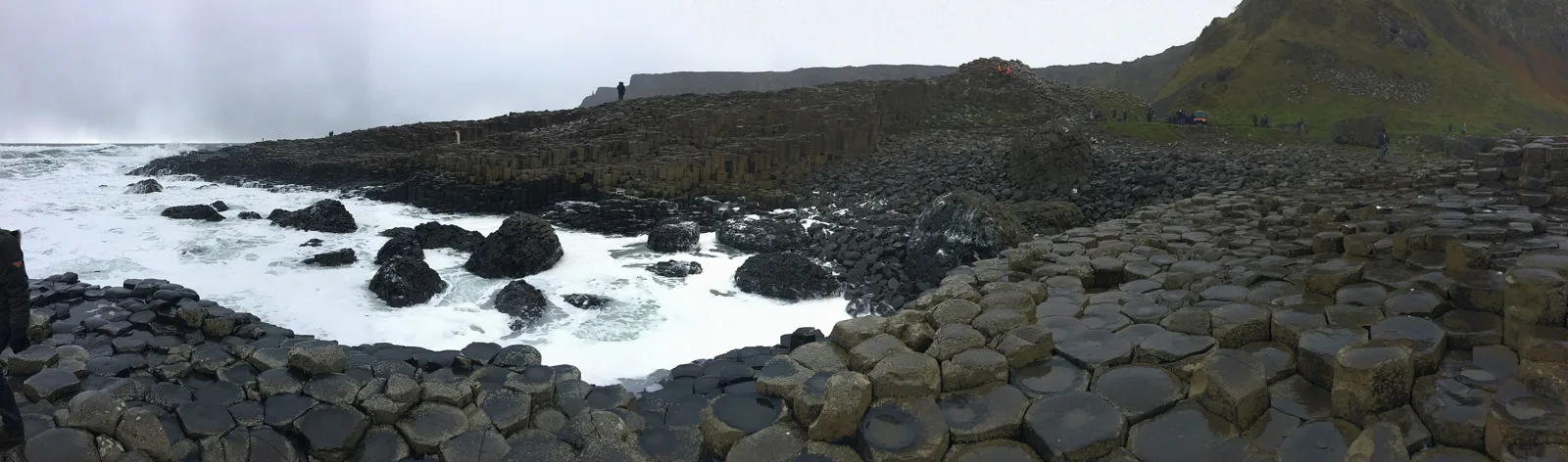
Near the water the columns get lower and lower until they slip beneath the waves. Stand there and it is easy to imagine the road carrying on under the sea.

Finn McCool and the cradle
The name comes from a legend, and the legend comes in several versions. In the one told by the National Trust, the Irish giant Finn McCool built a causeway across the sea so he could fight his rival, the Scottish giant Benandonner.
There was a problem: Benandonner turned out to be much bigger. So Finn's wife came up with a plan. She dressed Finn as a baby and tucked him into a cradle. When Benandonner arrived and saw the size of the "baby," he wondered how enormous the father must be, panicked and fled, tearing up the causeway as he went. That, the story goes, is why only the two ends remain. Even the British Geological Survey notes that some say the causeway was built by Finn McCool. It remains, of course, a story.
The real builder: a lake of lava
The geology is just as dramatic. According to the British Geological Survey, about 60 million years ago, at the start of the Palaeogene period, as the North Atlantic was beginning to open, volcanic activity flooded this area with lava. At the Causeway, it pooled into a lava lake some 90 metres deep.
As the lava cooled, slowly and evenly, it shrank. Contraction cracks spread through the entire mass, and the rock split along them into thousands of columns. Geologists call this columnar jointing. The giant, in other words, was a cooling lake of molten rock.

Three centuries of visitors
UNESCO says this dramatic sight inspired the legend of giants striding over the sea to Scotland, and that it has drawn visitors for at least 300 years. In 1768 an engraving was published from a painting by the artist Susanna Drury.
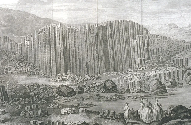

Visitors once carried off stones as souvenirs, a practice that ended once the site was protected. Today the rule is simple: leave the stones where they are and take home photographs instead.
The same columns across the sea
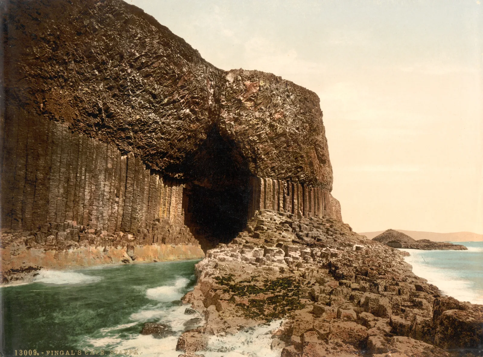
So is there really a road under the sea? No. But across the water, on the Scottish island of Staffa, there are basalt columns that look remarkably similar. The British Geological Survey says they formed in the same volcanic episodes that created the Giant's Causeway. In a sense, the legend points the right way: there really is matching rock where the giant's road was said to lead. Britannica also mentions the tale that Finn McCool built his bridge toward Staffa.

On a clear day you can even see Scotland from the clifftop paths. The National Trust says its Green Trail offers views of the Causeway, Scotland and the Inishowen Peninsula.
Find the Giant's Causeway on Wooriyeojido
A road said to be laid by a giant, and the 60-million-year-old lava that really built it. The Giant's Causeway is pinned on the Wooriyeojido map. Look it up in the Wooriyeojido app, and if you go, leave your photos and stories from the day right beside it.
View this place in the Wooriyeojido appVideos of nearby places
 When did the lake monster story begin? Loch Ness, Scotland
 The tomb the winter solstice sun enters: Newgrange, Ireland
 Stones carried across the sea by a wizard? Stonehenge